This will be a relatively short entry since by this time I was feeling pretty lousy and going out to look at this stuff would have taken a lot of tme and energy. But I still managed a couple of personal photos while on the way to and from various places.
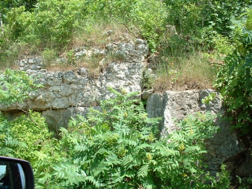
First of all, an omission from yesterday: The below is a photo of the same Niagara rock that I showed in the photos from High Cliff Park but this time about 60 miles south of there along a road between Fond du Lac and Eden:

So you really can trace this stuff a long way just by paying attention as you drive around.
Now, on to the Late Pleistocene!
Wisconsin marked the terminal extent of the last major glaciation called, not coincidentally, the Wisconsin glaciation. This page will give a better overview of it than I can. Suffice it to say there are numerous glacial geomorphologic features within just a few miles of Fond du Lac.
My family used to drive from FdL north along the Ledge (151) for about 20 miles and then up and over said Ledge and east over to Chilton where my maternal grandmother lived. I noticed early on that once we got over the Ledge the road crossed over numerous small hills. Turned out we were entering a drumlin field. For a good description of these see here. Years later when I would ride my bike up into the farmland after work during the summer I stopped at the crest of a hill and looked over to see an enormous ovoid hill, which ended up being part of an equally enormous drumlin field:

(from the web age above)
These things are very regular in their directionality and I had a geology prof in undergrad school who said he used to use them as navigation aids while flying. Well, while I was driving to Widmer's Cheese in Theresa to grab some fine Wisconsin cheese products, I found this absolutely ideal drumlim sitting in the distance over a marsh:

It's absolutely classic having its blunt end towards the northeast. It's hard to see these things clearly most of the time since they're usually covered with trees and other hills get in the way.
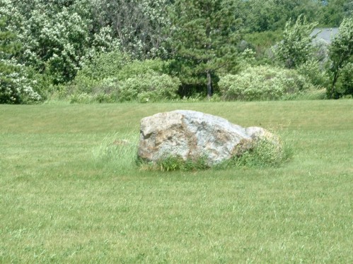
The other feature we see a lot of are glacial erratics which are stones that the ice carried down and dumped. The farmers around Wisconsin used to pull these things out of their fields all the time. I have something of a personal stake in this as my mother's father was killed while pulling one out of a field when she was a young girl, so I never knew him. They would have to regularly keep pulling them out because frost heave would keep pushing them up from lower down. They used to pile them up alongside their fields and create rock fences out of them; I tried to find some to photograph, but could not. I really remember them as a kid, but maybe they're all grown over with weeds in the summer. At any rate, I did find one good picture of a classic erratic:


Sorry about the focus in the second one. I took a close-up to show that it is probably a granite and thus obviously from elsewhere, as we have already seen that the buk of rock in SE Wisconsin is dolomite.
Check out the links pointed to above for other stuff related to Wisconsin glacial geology. There's a lot of cool stuff out there.