So last week I went to my ancestral home of Fond du Lac, WI. I had big plans of visiting all sorts of cool places, takng lots of photos and coming back here to regale y'all readers with the story of SE Wisconsin history and prehistory.
But I caught a cold on the flight back, so that put a damper on much traveling. Or visiting for that matter. Nevertheless, I bravely soldiered on and at least did a bit of running around. I learned a few things myself so it was good for me, too. Well, you know what they say, if you want to learn a lot about any subject, teach a class on it. So here goes with a bit on the local geology.
First, consult this map of the bedrock geology of the state (from Schultz 2004, Plate 1, I believe). The area in question is the eastern border of the state comprising the gray and narrow pink bands there, the former making up the entire peninsula. Fond du Lac is located at the bottom of the smaller lake there in the middle. The primary rock unit controlling the geology is Silurian (443-417 mya) resulting from a shallow sea that covered the area. The original rock was limestone, butsome was replaced by magnesium over time creating dolomite. It's still highly calcareous which accounts for the hard water that we got used to as kids; tea kettles (and coffee makers) periodically need to be cleaned with an acidic solution because the lime deposits build up. FdL gets its water from wells, tapping into water stored in the dolomite.
Growing up there, I used to think Wisconsin was boorrrrrring as far as geology went. The action was really happening out west where there were mountains! and volcanoes! and dinosaurs! and stuff like that. Wisconsin was mostly flat. Yawn. But it turns out, it's pretty interesting. As I mentioned, and as that map indicates, much of WI is underlain by very old rocks of Precambrian and Phanerozoic rocks. For whatever reason, deposition either ceased after the Devonian or was eroded away (probably the former). So, no dinosaurs or mountains, but some of the oldest rocks on the continent. On top of all this is some of the most classic glacial deposits found anywhere and in fact, many textbooks use features fom around there as examples.
Now, the Silurian dolomite (gray) is part of the Niagara Escarpment:

It makes up the rocks Niagara Falls goes over. In FdL we call the escarpment -- also called a cuesta -- The Ledge. Actually, it's only fairly recently that I discovered what exactly the Ledge was made out of. For a long while we were told it was a terminal moraine (which is kind of true, it's covered by gacial moraine). But no, it's a hard, resistant rock which is also responsible for the Door Peninsula. The Ledge runs up all along the side of Lake Winnebago there. We went up to High Cliff State Park which is about 45 miles north of FdL on the east side of the lake near the top. You can't actually see any "high cliffs" in these pictures because I didn't have the energy to hike more than one tral, but they're there. A trail runs along the top and through some indian mounds (later post):

Looking out over the bluff. Notice how flat that is. Not necessarily "manufactured" that way. Like most limestones it tends to fracture along planes, both vertically and horizontally:
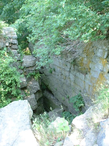
And because it's so hard, it tends to look almost like poured concrete at times. In fact, the parking lot by the trail head is almost misleading because the concrete in it blends almost insensibly into the natural rock. You can see this really well in this picture of an old quarry:
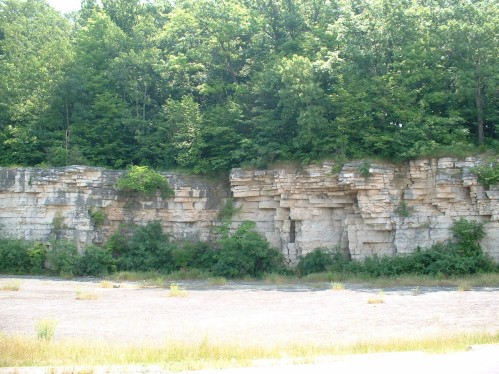
(which is a bit overexposed, sadly). But that flat area is dolomite. The small cliffs there show the typical fracture pattern of limestone.
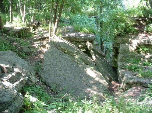
Here's another pic of the eroding and collapsing rock coming off in other horizontal sheets:
There used to be a lime kiln in the park at one point, but that was the trail I hadn't the energy to go hiking down. In truth, I'm not sure exactly how much building was done with Niagara dolomite; certainly a lot of lime was used for mortar. I've seen a couple pictures of buildings that may have used the dolomite itself as a building material and Schultz (2004) notes that it's fairly easy to work despite its hardness. But, I'm no geologist so just walking around looking at finished buildings doesn't tell me much. A lot of buildings in FdL look as if they were built of the stuff, but it could be something else, too.
Some of it is highly fossiliferous, as this indicates:
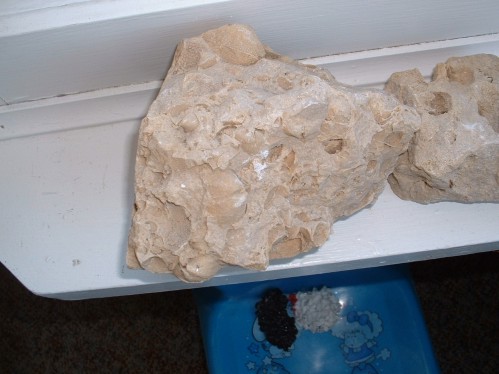
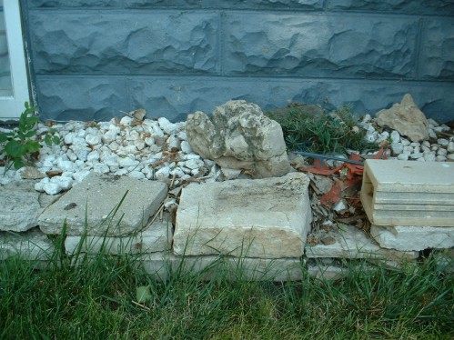
You can see it's chock full o' bivalves. I collected this years and years ago and it's been sitting on our porch ever since. t's neat stone and many, if not most, houses have some of it sitting around as decoration:
So that's the old stuff. Next up will be a bit of glacial geology and geomorphology.
References
Schultz, G. (2004). Wisconsin's Foundations: A review of the State's geology and its influence on geography and human activity. Madison, The University of Wisconsin Press.