More form the Valley of the Kings! Three, all related. First up, Don Ryan standing in a tomb:

Full image here.
I don't know if I took these or I got them from an earlier expedition. I think this is KV-27 but don't, um, quote me on that. Heh. These were left open and during the rare rainstorms in the area, Valley of the Kings being a wadi and all, water and sediment pours down the valley bring sediment with it. Any open tombs get flooded. This is the last flood event in this tomb. The top layer is a very fine silt or clay which develops polygonal cracks as it dries. Closeup here:

Full image here.
You can see by the one that's been tipped up that it's a pretty thick deposit, and that's just the fine top material (probably 10cm thick). The flooding is usually heavy and is a major problem in the Valley. Matter of fact, I think just a few years after these were taken they had a major flood event (update: it was 1994). Part of our work was to map the drainage channels in the Valley, some major, some minor. Depending on how long the tomb was open, it's flood deposits can be very substantial and if open for long enough the tomb can be nearly completely choked with sediment:

Full image here
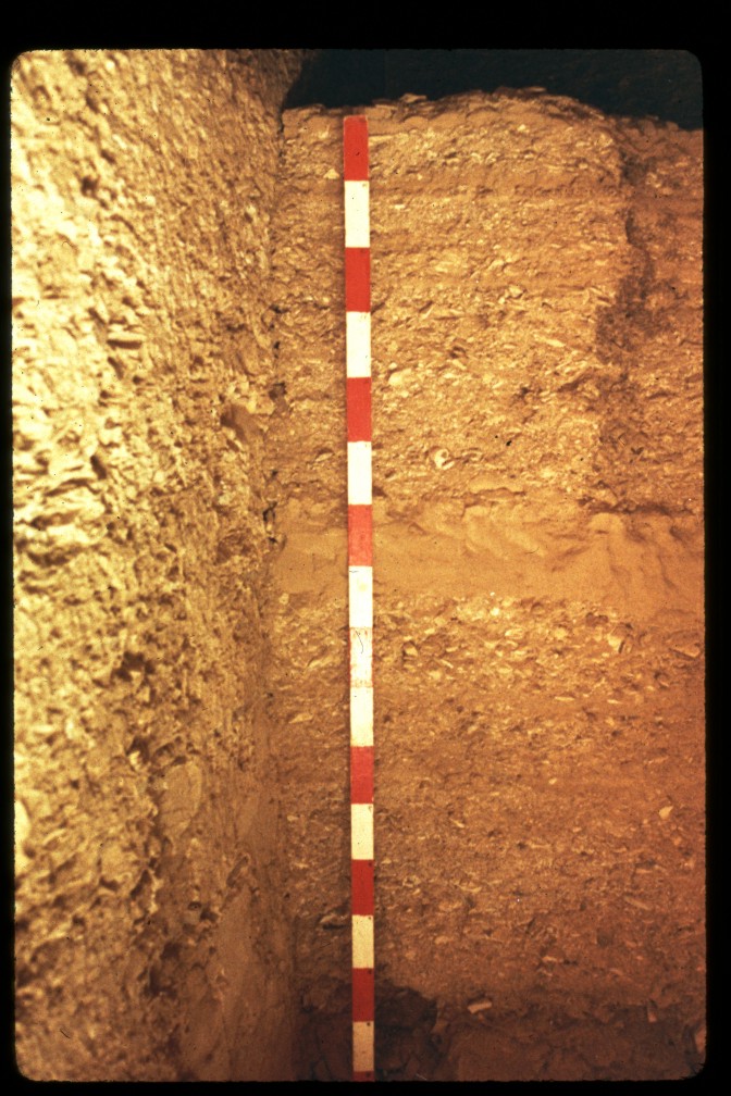
The strata are a bit difficult to see in that one, so here's a different column:

Full image here
The deposits form a "fining upwards" sequence -- fine particles stay in suspension longer and are deposited last -- so one can count the number of flood events that have taken place. Note the major one in the center. That whole deposit is 30 cm thick.
In the larger tombs, one can see another depositional process, though unfortunately don't have the photos handy (or scanned yet). Notably, in KV-8, the tomb of Merneptah you have a long narrow corridor opening into a large burial chamber. Looking at the plan view:

you can see it has four side-chambers off of the large burial chamber. When I was in there, these four chambers had yet to be cleared so you could still see the sediment column in them. In the one closest to the entrance, most of the sediment particles were large, while in the far ones the particles were predominantly fine. Why? It works in much the same way as an alluvial fan:

(from this page)
Can't find a good schematic section anywhere, darn it. Anyway, what happens is that as soon as the floodwaters exit the valley, or in this case the tomb corridor, the energy is quickly distributed over a much larger area. Larger particles immediately drop out of suspension, while smaller particles are carried further along, eventually dropping out as the energy dissipates.
I don't know if anyone has analyzed these tomb deposits specifically looking at the sediment columns to determine flood frequency. If you knew the date at which a tomb was opened last, you could certainly count the number of events since then and at least get an idea of the recent history for frequency and magnitude. There's probably some sections still remaining in these minor tombs, so if anyone needs a thesis project to work on. . . .